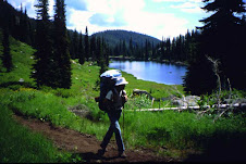
Trail Report - NV to Hammett
I biked from the NV border to the Snake River bridge by Hammett over the Memorial Day weekend. Roads are in reasonable shape, though that means they are very rocky and pocked with cattle tracks, and I averaged about 7-8 mph until I got up on top of the canyon above Winter Camp.
I ran into two sets of hikers. One set was hiking from Winter Camp to north of Hammett. Nice young couple just getting a section in.
The other is a thru-hiker team. One guy is named Dan and he and his wife started off at the NV border. She hiked with him to Hammett and then went home, but he was joined by two other guys, one of which is hiking the rest of the ICT with Dan. They hope to have it conquered by middle of July. I asked if they knew anything about this blog, which they didn't. I encouraged them to come here and update it so Leo can at least try to track how many hikers the ICT is seeing every year.
On that note, Dan mentioned that there was another set of 3-4 hikers in front of them that were planning on a thru-hike.
Thursday, May 31, 2018


Wednesday, May 23, 2018
Memorial Day Ride
I will be biking the Nevada to Hunter Transfer Camp over the Memorial Day weekend. Does anyone have a current trail report?
And - I will be posting a report when I finish.
And - I will be posting a report when I finish.
Tuesday, June 21, 2016
Trip Reports: Nevada to Stanley

Hey all--this is Tom from Pocatello. I've been nibbling away at the ICT this spring, and wanted to share some of my experiences. I've nearly completed the route from Murphy to above Stanley, and hope to go a bit further this summer. This is how it's gone thus far:
March 18-20 2016: Hammett to Featherville Highway (60 miles)

Eager to get going on the ICT this spring, I took the Salt Lake Express towards Boise and had them drop me in Hammett (unfortunately, I had them go off at the first exit, which doesn't have an on-ramp!). I walked six miles down through town and to the Snake River bridge where I camped on this mild spring evening.
The next day, charged up for my first solo hike, I covered 29 miles along the ranch roads and finally up into the rocks of the Bennett Hills; once I joined the Bennett Mountain Road, I camped at the Stott Crossing, making a lovely fire for the cooler night.
On Sunday, the snow shoes I had lugged along finally became usefully as the snow began in earnest on the upper reaches of the Bennett Hills and into the Fairfield valley. When I arrived at the Cat Creek intersection on Highway 20, my wife was still far off, so I hiked to the Castle Rock road, which was quite muddy and then snowy, through the amazing rocks, and out toward the Featherville Highway. Lucinda was still not there, so back out to Highway 20 where she picked up at the corrals--another 25 miles!
March 21 2016: Out to the Nevada Line (3 miles RT)

After spending the night in Twin Falls, Lucinda and I went to scout the start of the trail near Murphy Hot Springs (thus eliminating the need to re-do this section in May). We hiked out to the orange marker in the midst of snow squalls, taking three elk by surprise.
May 28-31 2016: The Owyhee Desert (90 miles)

At the end of May, my colleague Jim and I covered the desert from Murphy to the Snake River Bridge, alternating between walking the canyon rim (rough and full of cheat grass) and following the official route (long, hot, and at times overgrown). We managed to get water each day, first making out way to the Poison Creek crossing, where there was a (somewhat off-putting) pool right below the road. On the second day, we followed the official route to Wintercamp (a wearying 28 miles), and were amazed on the lovely river and semi-abandoned farm there. Such a pretty place!
Next day, we again left the official route as it bent northwards and returned to the canyon rim, ultimately descending for water in the Bruneau at the Robeson Trail crossing: the trail is neglected, largely due to a rock slide which was however easily traversable. We then turned back to the route at the Bruneau Overlook. We had thought to camp there, but no satisfactory place presented itself. We ended up camping on the side of the trail in the hard and weedy clay. The subsequent and final day began with another fairly faint bit of trail; this improved as we made our way down into Indian Cove, but the day got hot and the dried cheat grass and dead tumbleweed really called for gaiters. Exhausting!
June 6-7 2016: Near Stanley (36 miles)

These days found my patient wife helping me to bag a few sections up by Stanley: that Monday I went from Highway 21 on the Elk Creek trail to Stanley Lake (beautifully maintained, though buggy), and then from Stanley Lake to Grandjean. This involved a number of rather sketchy stream crossings, walking on the snow, and then an ill-advised mile-long bushwhack to avoid a double stream crossing. At the end, I managed to walk past Lucinda's campsite and added 3 miles. The following day's 12 mile walk along the Cape Horn road (through the camas meadows) was relaxing and concluded that section.
June 10-12: Featherville Highway to Atlanta (66 miles)

On June 9, my buddy Mike and I drove to Atlanta (somehow I managed to get my Honda over the steep and rocky James Creek road). We then drove his truck back to the Featherville Highway, after a stop at the pizza shop-rock shop, and camped.
The first day to Hunter Creek and then up the North Fork of Lime Creek was mostly just long--29 miles--but we did appreciate the restroom once we had descended to the campground at Willow Creek. While Grouse Butte was clear, we found Ross Peak to be snow-covered. We enjoyed a nice glissade down the north slope; subsequently, however, we found ourselves picking a path down steep icy slopes, and Mike took a rather scary fall but avoided injury. After about 18 miles, we camped in the Ross Fork Basin. On our final day, we lost the trail at the Mattingly / Alturas Divide (I somehow managed to replace the batteries on my gps with ... the old batteries). Once the snow softened up, we made our way to the wilderness boundary, where the top of the box with wilderness permits was only just visible. Mattingly Creek was glorious; the upper region showed painstaking trail work, but further down the trail was overgrown (one confusing section caused us an unnecessary stream crossing). The final crossing before we headed out to Atlanta was only just doable. Here's to hoping the water goes down for the Atlanta to Grandjean section, which I undertake next week!

Monday, May 30, 2016
ICT on The Trail Show podcast
I just got back from Boulder, CO where I joined the Trail Show crew of triple crown hikers to talk about my 2015 ICT thru-hike. They featured the Idaho Centennial Trail as trail of the month alongside a healthy selection of Idaho beers. You can download it using your own podcast app or by visiting their website here: The Trail Show: Episode 48 The ICT.
Tuesday, March 29, 2016
Trip report: Nevada line to Snake River
Hello! I wanted to
post a report on my recent ICT hike from the Idaho/Nevada line to Highway 78 (a
distance of 85 miles), 19-25 March 2016.
On Saturday the 19th, my wife and I drove to the
Murphy Hot Springs area where we hiked the two miles on the ICT from the road
to the Nevada line and back. We then
spent the night at the nearby BLM campground where we had the place to
ourselves. The next morning I started
hiking in earnest.

The trail is reasonably easy to follow using the maps from
the Idaho Parks and Rec site, following (for the most part) 4-wheeler trails
and marked by white Carsonite posts.
Unfortunately, about 80% of these posts no longer stand erect and are
thus generally found on the ground near the trail, thus still serving their
purpose, although not as originally intended.

There was a definite paucity of available water on the
trail. I found water a short distance
off-trail at the head of the Poison Creek canyon. The only other water I encountered was at the
bridge over East Fork Bruneau River (EFBR).
I did anticipate the water shortage and thus carried 6 liters of water
on each of the three stretches (Murphy Hot Springs to Poison Creek, Poison
Creek to EFBR, and EFBR to Highway 78).
This was an adequate amount of water to carry in the cool weather of my
hike; later in the season I could see this quantity as being insufficient.
Leaving EFBR I misplaced the ICT and thus ended up hiking on
the good NW-trending road for quite a distance until the ICT intersected this
road north of the side road to Bruneau Canyon Overlook. There was very little traffic on the road,
roughly 2-3 vehicles per hour. Over half
the vehicles stopped to inquire about my well-being.
Lastly, my hike was cold.
Anticipating this, I carried sufficient clothes to be comfortable and
safe. I am glad I carried extra clothes
(the mittens were wonderful!), regardless of their extra weight.
The scenery was, to be frank, rather uninteresting,
consisting almost entirely of flat sagebrush desert. But the descent off the high plateau into the
Snake River valley was very scenic indeed.
If you have any questions, please feel free to contact me at
stephenbrill@yahoo.com. Thanks for reading!
Monday, March 14, 2016
KIVI News does story on Idaho Centennial Trail
In case you missed it last night, a segment aired covering some of the work I have been doing raising trail awareness for the ICT. Though I felt like a bumbling dumby during the interview, they managed to put together a pretty compelling piece about the state of the trail and what it's future might be.
Should be a big year for the ICT and hiking season is quickly approaching! Happy hiking.
Should be a big year for the ICT and hiking season is quickly approaching! Happy hiking.
Saturday, March 12, 2016
New ICT book is now available
I finished my book about my 7 year hiking adventure on the Idaho Centennial Trail. It is titled "The Search for the Flat Ness Monster." It is available in paper and as an e-book.


Thursday, February 18, 2016
Great desert day hike on ICT
Hello,
This is Steve from Boise, Idaho. First time posting to this blog.
Just wanted to share my experience on Tuesday (16 February 2016) on the ICT. Two of my sons and I hiked the 4 miles from Alkali Rd. to Bennett Mountain Rd and back. It was a beautiful day, unseasonably warm for February. Blue skies, no wind. Very pleasant hike. No snow on the south-facing slopes but about 8 inches of wet unconsolidated snow on the north-facing slopes, which was just the last 1/4 mile. Without a doubt, the most memorable aspect of the hike was how many deer we saw. I do not exaggerate when I say we easily saw 200 deer in the 4.5 hours we were out.
I'll be hiking more on the ICT in the months and years to come. I would enjoy getting to know other hikers interested in the ICT.
That's all for now. Thanks for reading!
This is Steve from Boise, Idaho. First time posting to this blog.
Just wanted to share my experience on Tuesday (16 February 2016) on the ICT. Two of my sons and I hiked the 4 miles from Alkali Rd. to Bennett Mountain Rd and back. It was a beautiful day, unseasonably warm for February. Blue skies, no wind. Very pleasant hike. No snow on the south-facing slopes but about 8 inches of wet unconsolidated snow on the north-facing slopes, which was just the last 1/4 mile. Without a doubt, the most memorable aspect of the hike was how many deer we saw. I do not exaggerate when I say we easily saw 200 deer in the 4.5 hours we were out.
I'll be hiking more on the ICT in the months and years to come. I would enjoy getting to know other hikers interested in the ICT.
That's all for now. Thanks for reading!
Saturday, December 19, 2015
Atlanta to Willow Creek
On July 18th,
my 11 year old son and I started my next portion of the ICT. We were dropped off in Atlanta and took off
for the Willow Creek Camp Ground on the South Fork of the Boise River. It was a nice gradual climb as we headed to
the Sawtooth Wilderness. Things got
quite interesting as we started hiking along Mattingly Creek. The rain started to fall and we were coming
across a lot of Bear scat on the trail, a lot!
I didn’t want to scare my son, so we kept hiking at high alert. The Cat...
errr Bear was out of the bag as we came to a clearing and spotted a big
ole feller about 150 yards north of the trail.
He was just sitting on his butt checking things out in the meadow. We finished the rest of the hike in the rain,
and 11 miles later we got into camp soaking wet. We dried off the best we could and called it
a night, all the while of being on guard from our fury neighbor two miles down
the trail.
I don’t know what time the rain stopped, but we woke up to a
winter wonderland, as everything was frozen!
Unfortunately our shoes were still soaking wet, and they didn’t really
dry out until the end of this hiking day.
Hiking in wet boots is no fun at all, and drained a lot of our enthusiasm
and fun right out of our backpacking experience. We encountered some other ICT hikers who were
using Alpacas/Llamas; I might have to look into this! We stopped and checked out an old cabin and
carried on. We found a nice camp site along
the South Fork Ross Fork, right before it gets into some major climbing. My feet were shot; 12 blisters and an unusual
sharp pain in my Achilles tendon. This
is a really pretty area with a ton of huge deer! We completed around 11 miles today. I’ve got
to figure out this boot thing, I thought I had some good Merrell boots; maybe I
need to carry hiking sandals?
I woke up the next morning in excruciating pain in my feet
and Achilles, knowing that I had the worst part of the trip ahead of us. Hiking up Ross Peak was tough, but nothing we
couldn’t handle. The highlight would definitely
be coming within petting distance of an owl in a tree right on the trail. I took some more pain meds on top, and we then
started the slow and arduous trek down the 12.5 mile and 4350’ decent into
Willow Creek. I didn’t know what the
hell was going on with my Achilles, but our breaks were longer than our actual
hiking. I have to give it to my son; as I
had tears sneaking down my cheek, he was encouraging and had the “Let’s do this
dad” attitude! We encountered a couple
of deer and a fox, and then eventually made it to our pick up crew. The Podiatrist told me that I had Achilles Tendonitis,
thus ending my backpacking for the year.
Well, see you next year!


Monday, November 23, 2015
Thru-hike trip report
Hey all. Long time reader, first time poster. After hiking the AT and PCT, I've been eyeballing the ICT for years. The thought of a long distance trail in my own backyard... how could I resist? This year, the stars finally aligned and I set off to see first hand what this trail had to offer. I referred to this board many times as I researched the trail over the years and so I would like to contribute my own experiences so that others may benefit.
This was certainly a high risk/high reward type of hike. It is a full immersion wilderness experience. As others have said, this trail isn't the PCT, or the AT, or even the CDT. It is uniquely Idaho. And uniquely ICT. However, experience on some of our country's other long distance hikes will definitely help prepare you for this trip. It is important to be confident in your hiking, your ability to successfully plan and execute resupply drops, and to be prepared mentally for long, arduous days. Most importantly, it is critical that you can adapt and remain flexible as the trail will present new challenges every day.
The connection that you build with Idaho's backcountry on a trip like this will tie you to the geography of our state forever. It is a level of intimacy that, so far, only a few have chosen to pursue. To map the state out in your mind, from mountain to mountain and river to river, border to border; one yard at a time on your own two feet. There are few ways to replicate that sense of closeness with the rugged topography of the Gem State.
Here is a link to my Trail Journal. I updated this every day in a moleskin notebook and posted it to the website after the hike.
Here is a link to the Boise Weekly article that some of you may have seen. We even got voted 'Best Idaho Adventure' in the Best of Boise issue! Reporter Jessica Murri joined us for 60 miles from Atlanta to Stanley and wrote a great article about the experience. She is planning to hike the PCT in 2016 and this was her first long-distance hiking trial run.
And lastly, here is a video I put together documenting our trip. It was made more for family and friends but anyone who is interested in the trail is welcome to check it out:
I'm happy to field any questions. Leave a comment or send me an email at: alongslowdrift@gmail.com. Many thanks to all the previous posters on this blog. And to anyone who has dared to go out and bushwhack their way along the ICT, my hats off to you.
-Clay
This was certainly a high risk/high reward type of hike. It is a full immersion wilderness experience. As others have said, this trail isn't the PCT, or the AT, or even the CDT. It is uniquely Idaho. And uniquely ICT. However, experience on some of our country's other long distance hikes will definitely help prepare you for this trip. It is important to be confident in your hiking, your ability to successfully plan and execute resupply drops, and to be prepared mentally for long, arduous days. Most importantly, it is critical that you can adapt and remain flexible as the trail will present new challenges every day.
The connection that you build with Idaho's backcountry on a trip like this will tie you to the geography of our state forever. It is a level of intimacy that, so far, only a few have chosen to pursue. To map the state out in your mind, from mountain to mountain and river to river, border to border; one yard at a time on your own two feet. There are few ways to replicate that sense of closeness with the rugged topography of the Gem State.
Here is a link to my Trail Journal. I updated this every day in a moleskin notebook and posted it to the website after the hike.
Here is a link to the Boise Weekly article that some of you may have seen. We even got voted 'Best Idaho Adventure' in the Best of Boise issue! Reporter Jessica Murri joined us for 60 miles from Atlanta to Stanley and wrote a great article about the experience. She is planning to hike the PCT in 2016 and this was her first long-distance hiking trial run.
And lastly, here is a video I put together documenting our trip. It was made more for family and friends but anyone who is interested in the trail is welcome to check it out:
I'm happy to field any questions. Leave a comment or send me an email at: alongslowdrift@gmail.com. Many thanks to all the previous posters on this blog. And to anyone who has dared to go out and bushwhack their way along the ICT, my hats off to you.
-Clay
Monday, October 26, 2015
This past summer my girlfriend and I hiked the ICT from Featherville, ID (south of the Sawtooths), north to HWY 12. We had a great adventure and would be happy to answer any questions, general or specific, about trail conditions, resupply ect... The main takeway is that this trail is really more of a route; not at all similar to the PCT in that you'll actually be in the wilds alone and that signage and maintenance are sparse. We did about 12 miles/day and that was certainly tough enough in the jungle gym of the ICT. For naviagtion we used the ICT maps from the Idaho parks site, a compass, and a keen Sacajawea intuition.


Wednesday, August 26, 2015
I'm back from another trip on the ICT in the Selway-Bitterroot Wilderness. My objective was to walk south to the point where I turned around going north in 2013. I didn't quite make it: too many burns and blowdowns in the Rhoda Creek basin.
I've posted a trip report at my website:
http://www.oberlin.edu/physics/dstyer/Backpacking
More importantly, I've written up the lessons from my 2013 and 2015 trips as "ICT Hiking Tips". These tips are also available through the above website.
I've posted a trip report at my website:
http://www.oberlin.edu/physics/dstyer/Backpacking
More importantly, I've written up the lessons from my 2013 and 2015 trips as "ICT Hiking Tips". These tips are also available through the above website.
Sunday, May 3, 2015
Murphy Hot Spring to Highway 20, April 2015
May 3, 2015
Over the past two weekends I biked the southern portion of the ICT. The first weekend was from near Hill City to Hammett, Idaho. This ride was mostly on gravel roads with about a 3 mile stretch of cross country travel. The cross country portion well marked but not maintained. I had to push my bike for about 1 mile along this stretch. Water was available at several locations along this route although I suspect some of the sources would not provide water in the summer months. This portion of the trip took about 12 hours total. Overall it was enjoyable with plenty of songbirds for company.


The "trail " dropping off the bluffs from Mt. Bennett towards Hammett.
My second weekend was from Hammett to Murphy Hot Springs which took me about 24 hours over a period of 2.5 days. I am posting this to give people an idea of the conditions out there. The only water I encountered was at winter camp on clover creek aka east fork bruneau. With 80 degree temperatures 1 gallon of water plus a full camelbak was enough to last me a day. I did this portion unsupported without a water cache. I would not recommend this desert portion when temperature get above 90F unless you have support and plenty of water. Several trail junctions were missing ICT carsonite markers. The spaghetti of roads near poison butte proved to be the most confusing. I got off route several times and had to rely on a GPS to get me back on the trail.
The road was too rough to ride for many stretches. I had to push my bike for many miles due to nasty conditions. I agree with a previous post saying about 30% of the Bruneau stretch is hard pack easy riding. The rest is rutted out, beat out by cattle or very rocky. The trip was a great experience with plenty of type B fun. Don't hesitate to ask me questions if you are thinking about doing this stretch of the ICT.
3 photos of the varying condition you will encounter along the ICT Bruneau desert portion. The last photo is another reason I hate cattle.


The "trail " dropping off the bluffs from Mt. Bennett towards Hammett.
My second weekend was from Hammett to Murphy Hot Springs which took me about 24 hours over a period of 2.5 days. I am posting this to give people an idea of the conditions out there. The only water I encountered was at winter camp on clover creek aka east fork bruneau. With 80 degree temperatures 1 gallon of water plus a full camelbak was enough to last me a day. I did this portion unsupported without a water cache. I would not recommend this desert portion when temperature get above 90F unless you have support and plenty of water. Several trail junctions were missing ICT carsonite markers. The spaghetti of roads near poison butte proved to be the most confusing. I got off route several times and had to rely on a GPS to get me back on the trail.
The road was too rough to ride for many stretches. I had to push my bike for many miles due to nasty conditions. I agree with a previous post saying about 30% of the Bruneau stretch is hard pack easy riding. The rest is rutted out, beat out by cattle or very rocky. The trip was a great experience with plenty of type B fun. Don't hesitate to ask me questions if you are thinking about doing this stretch of the ICT.
3 photos of the varying condition you will encounter along the ICT Bruneau desert portion. The last photo is another reason I hate cattle.

Sunday, February 1, 2015
Hello all, My name is Claine and I just moved to Idaho recently. I was looking on the web for hiking trails, came across the ICT and it interested me. I am planning to hike the complete trail in 2016. I wonder if anyone can help me with some information: Which direction is best, and when to set out; can food be cached, or does someone have to meet you at a trail access point; any special permits, or permissions needed.
I have looked through everything I could find on the web but these questions are still open. If anyone can help me it would be greatly appreciated, Thanks.
I have looked through everything I could find on the web but these questions are still open. If anyone can help me it would be greatly appreciated, Thanks.
Sunday, January 18, 2015
Hwy 20 – Willow Creek C.G.
On 8-1-2014 my 10 year old son, my father in law, and I started my next portion of ICT. Because of my previous bad luck on this trail, and bringing my young son this time, you can bet that I had my stuff together on this trip. We rode the 19 miles to Hunter Transfer Camp on mountain bikes, with no setbacks. The Castle Rocks were pretty cool, but we really didn’t stop to admire their awkwardness. The first two miles were downhill and the last two miles were downhill, but everything in between was a gradual uphill climb on gravel or paved roads. We took a long good break at H.T.C. then threw our packs on and began the walking express. We only hiked approximately 4 miles, and camped near Ellis Gulch. Saw a few deer on the way there, but that was it for the rest of the trip. As soon as we went to sleep that night, it started raining, and didn’t stop until right before we woke up. Today’s hike would be approximately 9 miles, and a 2100’ climb. I don’t know if was from all the rain, but we had to cross the creek approximately 12 times, and about 5 of those crossings were walking through the water. Have your water shoes and towel handy! Two miles from the top, there is a sign indicating 2-miles until Grouse Butte, make sure you get water here!!! This is the last water until you hit the South Fork Boise River. These last two miles were a little tough, but worth the view on the top. The next day we walked down five miles to Willow Creek C.G. This is a 2400’ drop, and got pretty steep in some points. When we got close to the South Fork Boise River, I’m pretty sure I heard a rattlesnake in the bush, and then saw a dead one on the road along the river. Keep your head up in this area! I was pretty disappointed that we didn’t see much wildlife, especially after my wife bought me bear spray, because she wouldn’t let our son come without it. Well, it now time to get some of this winter sludge off, and get ready for this summer, as I want to get to Dagger Falls before the end of hiking season. Until next time, be safe out there!


Hwy 20 - Snake River
After almost two years of an absence and one knee surgery, I decided it was time to get back to work on completing the ICT. So, on 5-31-2014, two friends and I tackled the trail yet again. This trip would be with Bill and Aaron, Aaron was the buddy who made it to our destination on my first segment. We last left off at the Snake River, but decided to do this next segment in reverse. We would start our journey On Hwy 20 and proceed southbound rather than north. So far our ICT journey has brought forth medical evacuations, laughs, tears, and bad trails, so why would this one be any different!? So I will start this story out at my house, in my driveway loading our mountain bikes. My bike rack is a Wal-Mart model, it’s not the best, but it does get the job down with some minor bike configurations. You have to take the seat post out of the bike frame to get all of our bikes onto this rack. This is no big deal, but it would add to our already story filled journey on this trail. We get to our starting point and unload all of our bikes and gear. Aaron and I get our seat post back onto our bikes and are already to go, but Bill is still working on getting his seat post back into his frame. The seat post goes into the frame, but will not slide down into position. On any other occasion, we would have brainstormed this issue and figured out the problem, but no, not on our ICT journey! We had mistakenly thought that due to the elevation and temperature change that his frame had somehow tightened up. So what do we do, but forcefully push this seat post into the frame of his bike. It then occurred to us that we must have mixed up our seat post, and Bill was trying to put Aaron’s seat post into his bike frame. The damage was already done, the seat post wasn’t coming out, and we had no tools to assist us with this issue. Aaron and I suggested for us to go back home and try again some other day, but not Bill! Even though he could barely touch the pedals, he wanted to get today’s segment done. This was supposed to be an easy 5-mile ride uphill then a ton of downhill riding. Four miles into our trip, Bill said enough, and he couldn't ride like this anymore! So we put our heads together, got out all tools that we had, and come up with a plan. Two hours later, and two saw blades completely grounded down to nothing from my multi-tool, we cut through the seat post and lower the seat to a more suitable position. We get off Bennett Mountain road and start headed cross country to Steen road, but not before we get some lunch. This cross country portion is pretty technical, and sketchy, but well marked. Aaron and I are pretty avid bikers and had no problems with this part. Don’t get me wrong, Bill is probably the most athletic/ in-shape out of the three of us, but today wasn’t his day. During this portion, he flipped over his handle bars and somehow broke his foot (revealed by x-ray the next day) The rest of the trail is gravel or paved road, but our/Bill’s bad luck wasn’t over. We had to stop and change two flat tires on Bill’s bike, but the tubes wouldn’t hold air for some reason. So, we had to stop every 15 minutes to add more air to his tire. Then after all of our bad luck, we finally finished at the Snake River, Thank God!


Thursday, January 15, 2015
Owyhee Desert pt. 2
On 9-28-2012, my buddy Bill and I continued where some friends and
I had finished off last time. He had
actually backpacked from the Nevada State line to the Bruneau Canyon Overlook
over three days in the last part of the 2011 summer. Like my previous bad experience on the first
portion of this leg, he too ran into water issues. Our journey this day would be on mountain
bikes, and he didn't mind backtracking and starting at WinterCamp with me. The first ten miles to the Bruneau Canyon Overlook
went well. We stopped and looked over
the edge for a little bit, then continued straight north. Problem is that you’re actually supposed to
travel out to the east to continue on the ICT.
So, after two miles we realized our mistake and had to fix our predicament. We made it back onto the trail, found the
Clover 3 Creek Rd, paralleled the Bombing Range, and were able to see a few
fighter jets flying by pretty low. The
ride down in Browns Creek was beautiful, and we didn't have to pedal for almost
4 miles, but then came the suck!
Apparently at this time of the year, every cow in the desert has used
this road as a central highway, which doesn't make for a good riding path. Almost 80% of the road was made up of 4” of super
soft dust, which made it impossible for bikes.
A vast majority of our time on our journey was getting the dirt out of
our gears and just walking the bikes. We
got to Pothole road and took a long well deserved break. We continued northbound and met up with our
pickup team at the Snake River Bridge on Hwy 78. So we picked a great day to cover these 35 miles;
as we didn't encounter any rattlesnakes, it never hit over 80 degrees, and
there was partial cloud cover.

Saturday, January 3, 2015
Sunday, December 28, 2014
ICT meet IBT
I am posting this on behalf of Mike O'Brien. Mike successfully thru-hiked the Idaho Centennial Trail in 2010. He has gone on to make two successful hikes around the perimeter of Idaho. Mike, along with his friend "Yeti" has pioneered a route they are calling the Idaho Boundary Trail. Information about this trail is now posted on a new website:
http://www.fultek.com/ibt/

http://www.fultek.com/ibt/
Wednesday, September 10, 2014
ICT East alternate route
it was planned as a 30+ mile section of the Idaho Centennial Trail, East alternate route, from near
Alturas Lake, through Johnson Creek, over to Emma Creek, up Emma Creek to Big Smoky Creek, then down FR215 to Highway 75 below Galena Summit. Jerry Finnegan and I planned it for Labor Day weekend. We started on Sunday, August 31st, at the trailhead near Alturas Lake. Things went well for the first 6 miles or so. We reached the Idaho Centennial Trail near Mattingly Divide, and were on the main ICT for just a half mile or so before reaching the junction with the ICT East trail going into the Johnson Creek drainage. About a mile and half down this trail, my ankle suddenly gave way beneath me. My momentum caused me to do a complete somersault, and I landed on my back with my feet facing down the slope. Fortunately I didn't continue to roll. The damage was done, however. My ankle was severely strained, though not broken. Through the rest of the afternoon I hobbled on down the trail. Our campsite was not the greatest, but we made the most of it, and the next morning we continued on. We had accepted that we would not get done by Tuesday and were trying to figure out how to get a message out to our wives. As the day progressed, it became apparent that I was not going to get even to the half way point of the hike. We decided to come off the trail at Emma Creek, where it meets the South Fork of the Boise road (NFD road 079).
We were helped by Roger and Mary Ann on their ATV. They got us down the road to a Methodist church camp where we were able to send messages out by satellite internet. Jerry's wife Betty and son Brian came to the rescue. Sometimes it's better to live to hike another day......
pictures here....
share.shutterfly.com/action/welcome?sid=0ActGbJq2YsWrDTA
Ron
http://llamasyndrome.blogspot.com
Alturas Lake, through Johnson Creek, over to Emma Creek, up Emma Creek to Big Smoky Creek, then down FR215 to Highway 75 below Galena Summit. Jerry Finnegan and I planned it for Labor Day weekend. We started on Sunday, August 31st, at the trailhead near Alturas Lake. Things went well for the first 6 miles or so. We reached the Idaho Centennial Trail near Mattingly Divide, and were on the main ICT for just a half mile or so before reaching the junction with the ICT East trail going into the Johnson Creek drainage. About a mile and half down this trail, my ankle suddenly gave way beneath me. My momentum caused me to do a complete somersault, and I landed on my back with my feet facing down the slope. Fortunately I didn't continue to roll. The damage was done, however. My ankle was severely strained, though not broken. Through the rest of the afternoon I hobbled on down the trail. Our campsite was not the greatest, but we made the most of it, and the next morning we continued on. We had accepted that we would not get done by Tuesday and were trying to figure out how to get a message out to our wives. As the day progressed, it became apparent that I was not going to get even to the half way point of the hike. We decided to come off the trail at Emma Creek, where it meets the South Fork of the Boise road (NFD road 079).
We were helped by Roger and Mary Ann on their ATV. They got us down the road to a Methodist church camp where we were able to send messages out by satellite internet. Jerry's wife Betty and son Brian came to the rescue. Sometimes it's better to live to hike another day......
pictures here....
share.shutterfly.com/action/welcome?sid=0ActGbJq2YsWrDTA
Ron
http://llamasyndrome.blogspot.com
Subscribe to:
Posts (Atom)