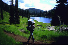
On 8-1-2014 my 10 year old son, my father in law, and I started my next portion of ICT. Because of my previous bad luck on this trail, and bringing my young son this time, you can bet that I had my stuff together on this trip. We rode the 19 miles to Hunter Transfer Camp on mountain bikes, with no setbacks. The Castle Rocks were pretty cool, but we really didn’t stop to admire their awkwardness. The first two miles were downhill and the last two miles were downhill, but everything in between was a gradual uphill climb on gravel or paved roads. We took a long good break at H.T.C. then threw our packs on and began the walking express. We only hiked approximately 4 miles, and camped near Ellis Gulch. Saw a few deer on the way there, but that was it for the rest of the trip. As soon as we went to sleep that night, it started raining, and didn’t stop until right before we woke up. Today’s hike would be approximately 9 miles, and a 2100’ climb. I don’t know if was from all the rain, but we had to cross the creek approximately 12 times, and about 5 of those crossings were walking through the water. Have your water shoes and towel handy! Two miles from the top, there is a sign indicating 2-miles until Grouse Butte, make sure you get water here!!! This is the last water until you hit the South Fork Boise River. These last two miles were a little tough, but worth the view on the top. The next day we walked down five miles to Willow Creek C.G. This is a 2400’ drop, and got pretty steep in some points. When we got close to the South Fork Boise River, I’m pretty sure I heard a rattlesnake in the bush, and then saw a dead one on the road along the river. Keep your head up in this area! I was pretty disappointed that we didn’t see much wildlife, especially after my wife bought me bear spray, because she wouldn’t let our son come without it. Well, it now time to get some of this winter sludge off, and get ready for this summer, as I want to get to Dagger Falls before the end of hiking season. Until next time, be safe out there!
Sunday, January 18, 2015
Hwy 20 - Snake River
After almost two years of an absence and one knee surgery, I decided it was time to get back to work on completing the ICT. So, on 5-31-2014, two friends and I tackled the trail yet again. This trip would be with Bill and Aaron, Aaron was the buddy who made it to our destination on my first segment. We last left off at the Snake River, but decided to do this next segment in reverse. We would start our journey On Hwy 20 and proceed southbound rather than north. So far our ICT journey has brought forth medical evacuations, laughs, tears, and bad trails, so why would this one be any different!? So I will start this story out at my house, in my driveway loading our mountain bikes. My bike rack is a Wal-Mart model, it’s not the best, but it does get the job down with some minor bike configurations. You have to take the seat post out of the bike frame to get all of our bikes onto this rack. This is no big deal, but it would add to our already story filled journey on this trail. We get to our starting point and unload all of our bikes and gear. Aaron and I get our seat post back onto our bikes and are already to go, but Bill is still working on getting his seat post back into his frame. The seat post goes into the frame, but will not slide down into position. On any other occasion, we would have brainstormed this issue and figured out the problem, but no, not on our ICT journey! We had mistakenly thought that due to the elevation and temperature change that his frame had somehow tightened up. So what do we do, but forcefully push this seat post into the frame of his bike. It then occurred to us that we must have mixed up our seat post, and Bill was trying to put Aaron’s seat post into his bike frame. The damage was already done, the seat post wasn’t coming out, and we had no tools to assist us with this issue. Aaron and I suggested for us to go back home and try again some other day, but not Bill! Even though he could barely touch the pedals, he wanted to get today’s segment done. This was supposed to be an easy 5-mile ride uphill then a ton of downhill riding. Four miles into our trip, Bill said enough, and he couldn't ride like this anymore! So we put our heads together, got out all tools that we had, and come up with a plan. Two hours later, and two saw blades completely grounded down to nothing from my multi-tool, we cut through the seat post and lower the seat to a more suitable position. We get off Bennett Mountain road and start headed cross country to Steen road, but not before we get some lunch. This cross country portion is pretty technical, and sketchy, but well marked. Aaron and I are pretty avid bikers and had no problems with this part. Don’t get me wrong, Bill is probably the most athletic/ in-shape out of the three of us, but today wasn’t his day. During this portion, he flipped over his handle bars and somehow broke his foot (revealed by x-ray the next day) The rest of the trail is gravel or paved road, but our/Bill’s bad luck wasn’t over. We had to stop and change two flat tires on Bill’s bike, but the tubes wouldn’t hold air for some reason. So, we had to stop every 15 minutes to add more air to his tire. Then after all of our bad luck, we finally finished at the Snake River, Thank God!
Thursday, January 15, 2015
Owyhee Desert pt. 2
On 9-28-2012, my buddy Bill and I continued where some friends and
I had finished off last time. He had
actually backpacked from the Nevada State line to the Bruneau Canyon Overlook
over three days in the last part of the 2011 summer. Like my previous bad experience on the first
portion of this leg, he too ran into water issues. Our journey this day would be on mountain
bikes, and he didn't mind backtracking and starting at WinterCamp with me. The first ten miles to the Bruneau Canyon Overlook
went well. We stopped and looked over
the edge for a little bit, then continued straight north. Problem is that you’re actually supposed to
travel out to the east to continue on the ICT.
So, after two miles we realized our mistake and had to fix our predicament. We made it back onto the trail, found the
Clover 3 Creek Rd, paralleled the Bombing Range, and were able to see a few
fighter jets flying by pretty low. The
ride down in Browns Creek was beautiful, and we didn't have to pedal for almost
4 miles, but then came the suck!
Apparently at this time of the year, every cow in the desert has used
this road as a central highway, which doesn't make for a good riding path. Almost 80% of the road was made up of 4” of super
soft dust, which made it impossible for bikes.
A vast majority of our time on our journey was getting the dirt out of
our gears and just walking the bikes. We
got to Pothole road and took a long well deserved break. We continued northbound and met up with our
pickup team at the Snake River Bridge on Hwy 78. So we picked a great day to cover these 35 miles;
as we didn't encounter any rattlesnakes, it never hit over 80 degrees, and
there was partial cloud cover.
Saturday, January 3, 2015
Sunday, December 28, 2014
ICT meet IBT
I am posting this on behalf of Mike O'Brien. Mike successfully thru-hiked the Idaho Centennial Trail in 2010. He has gone on to make two successful hikes around the perimeter of Idaho. Mike, along with his friend "Yeti" has pioneered a route they are calling the Idaho Boundary Trail. Information about this trail is now posted on a new website:
http://www.fultek.com/ibt/
Wednesday, September 10, 2014
ICT East alternate route
it was planned as a 30+ mile section of the Idaho Centennial Trail, East alternate route, from near
Alturas Lake, through Johnson Creek, over to Emma Creek, up Emma Creek to Big Smoky Creek, then down FR215 to Highway 75 below Galena Summit. Jerry Finnegan and I planned it for Labor Day weekend. We started on Sunday, August 31st, at the trailhead near Alturas Lake. Things went well for the first 6 miles or so. We reached the Idaho Centennial Trail near Mattingly Divide, and were on the main ICT for just a half mile or so before reaching the junction with the ICT East trail going into the Johnson Creek drainage. About a mile and half down this trail, my ankle suddenly gave way beneath me. My momentum caused me to do a complete somersault, and I landed on my back with my feet facing down the slope. Fortunately I didn't continue to roll. The damage was done, however. My ankle was severely strained, though not broken. Through the rest of the afternoon I hobbled on down the trail. Our campsite was not the greatest, but we made the most of it, and the next morning we continued on. We had accepted that we would not get done by Tuesday and were trying to figure out how to get a message out to our wives. As the day progressed, it became apparent that I was not going to get even to the half way point of the hike. We decided to come off the trail at Emma Creek, where it meets the South Fork of the Boise road (NFD road 079).
We were helped by Roger and Mary Ann on their ATV. They got us down the road to a Methodist church camp where we were able to send messages out by satellite internet. Jerry's wife Betty and son Brian came to the rescue. Sometimes it's better to live to hike another day......
pictures here....
share.shutterfly.com/action/welcome?sid=0ActGbJq2YsWrDTA
Ron
http://llamasyndrome.blogspot.com
Alturas Lake, through Johnson Creek, over to Emma Creek, up Emma Creek to Big Smoky Creek, then down FR215 to Highway 75 below Galena Summit. Jerry Finnegan and I planned it for Labor Day weekend. We started on Sunday, August 31st, at the trailhead near Alturas Lake. Things went well for the first 6 miles or so. We reached the Idaho Centennial Trail near Mattingly Divide, and were on the main ICT for just a half mile or so before reaching the junction with the ICT East trail going into the Johnson Creek drainage. About a mile and half down this trail, my ankle suddenly gave way beneath me. My momentum caused me to do a complete somersault, and I landed on my back with my feet facing down the slope. Fortunately I didn't continue to roll. The damage was done, however. My ankle was severely strained, though not broken. Through the rest of the afternoon I hobbled on down the trail. Our campsite was not the greatest, but we made the most of it, and the next morning we continued on. We had accepted that we would not get done by Tuesday and were trying to figure out how to get a message out to our wives. As the day progressed, it became apparent that I was not going to get even to the half way point of the hike. We decided to come off the trail at Emma Creek, where it meets the South Fork of the Boise road (NFD road 079).
We were helped by Roger and Mary Ann on their ATV. They got us down the road to a Methodist church camp where we were able to send messages out by satellite internet. Jerry's wife Betty and son Brian came to the rescue. Sometimes it's better to live to hike another day......
pictures here....
share.shutterfly.com/action/welcome?sid=0ActGbJq2YsWrDTA
Ron
http://llamasyndrome.blogspot.com
Monday, September 8, 2014
Two Walk North
I'd like to introduce myself and say I'll be posting periodically on the ICT Blog as Leo was gracious enough to give me permissions. My name is Mike Ingram and I live in Mountain Home, ID. I'm 55 years of age and retired from the Air Force in 2008 after a 30 year career. I'm hoping you won't be able to tell from my writing, but you certainly could if we met in person, that I'm originally from Georgia. Even though I left there at the age of 19, the accent is still distinctive and ever present. I got involved with the ICT after meeting my lady friend, Cindy Miller, who lives in Sweet Home, Oregon. Cindy and I both like to hike and I have a good bit of experience with long distance backpacking. Even though I'm retired, Cindy works as a pharmacy technician. While she has a significant number of paid vacation days each year, our backpacking has to be done in smaller chunks of a week to 10 days duration. So starting back in 2011, I mentioned we should backpack the Idaho Centennial Trail, attempting to do 130-150 miles per year, with a goal of finishing it before I turn 60. We started that first year at the Nevada state line. It didn't take long to realize we weren't as prepared as we'd thought. After getting the truck stuck on the first day, we began our hike on the 2nd day and made approximately 20 miles before my feet were so blistered from a poor choice of shoes that Cindy had to call a friend to extract us. We were determined though and came back the following season to hike from where we'd left off the first year, across the Owyhee Desert, over the Bennett Hills and to the Castle Rock road. It seems like a long time and distance ago now, but we've just recently completed a section from Thunder Mountain to Dagger Falls and next week will do a short section from the MacGruder Corridor towards the Selway. I'll have to do my end-of-year calculations later this year, but I know we'll have somewhere between 350 and 400 total miles at the end of this season. We've completed the southern portion up to Thunder Mountain and are now working on the middle section. Luckily, we've been keeping photographic and written records of our trips and I'll also add some of those as I have time over this winter. We're both feeling healthy and energized at this point and it's five more years before I'm 60, so I'm expecting we'll pull it off. I'm looking forward to sharing our story on this blog.
Thursday, January 30, 2014
re: Long Distance Hiking Class
I was able to attend the Tuesday session of Michael O'Brien's Ultralight Backpacking class. It was very interesting and he had a lot of stories from 2009 ICT and from his "Around Idaho" perimeter hike last year. The slide show had a lot of great pictures and it was fun to remember places I have been along the trail. He is having the second half of the class tonight Thursday 1/30 @ 6:30 pm @ West Junior High. one of the slides that he showed was meeting Marcia Powers, who thru hiked with her husband Ken in 2009, then solo hiked southbound for about half the ICT. I like to try to make sure we get the names of ICT completers on this blog, since it's still fairly new and a rare accomplishment.
so Michael O'Brien Class of 2009. Well done! that was a big year for the ICT.
Ken and Marcia Powers, my friend Jerry Finnegan, Bart Robinson, and Michael 0'Brien.
any others out there that I missed from 2009?
Ron (Class of 2011)
http://llamasyndrome.blogspot.com
so Michael O'Brien Class of 2009. Well done! that was a big year for the ICT.
Ken and Marcia Powers, my friend Jerry Finnegan, Bart Robinson, and Michael 0'Brien.
any others out there that I missed from 2009?
Ron (Class of 2011)
http://llamasyndrome.blogspot.com
Tuesday, January 7, 2014
Long Distance Hiking Class
I'll be teaching an evening class in lightweight backpacking gear and long distance hiking:
Class # 14W-GAR-002
Tu and Th from 6:30 PM to 8:30 PM
January 28-30, 2014 (Tue, Thu)
West Junior High
Also, a suggestion for a scenic alternate route south of Clark Fork:
This route is longer, but avoids heavily traveled roads.
It has plenty of water, unlike the official route.
It's much more scenic
Turn off Forest Service Road 430 on the good trail down to Jordan Spring
Continue on the trail down Alden Creek (There were several blowdowns across the trail in 2012)
The trail crosses Alden Creek at the confluence with the North Fork of Coeur d'Alene River
Hike downstream on Coeur d'Alene National Recreation Trail
There is a damp crossing of some beaver ponds at Deer Creek
Downstream from there, the trail is one of the most scenic I've seen in Idaho
Turn north on the Clark Fork Road #306 at Big Meadows
At the road junction at the border of Shoshone and Bonner Counties, take road #1066 north
Turn right on mountain bike trail #606
This leads you back eventually to road #1066, which takes you to Clark Fork
I plan to walk around Idaho again this summer.
Mike O'Brien
boisemobrien@gmail.com
Saturday, September 28, 2013
Trail Work on Marble Creek!
An update from Marble Creek Trail #222- a tributary of the Middle Fork of the Salmon River.
A 4-person crew from the Selway-Bitterroot Frank Church Foundation started up Marble Creek on the 10th of September 2013 after flying into Thomas Creek Ranch. We spent 8 days working up Marble Creek (working upstream, toward the Thunder Mtn. Trailhead), and are pleased to have cleared most of the trail.
This is the 3rd year in a row the Selway Bitterroot Frank-Church Foundaiton has worked on clearing Marble Creek Trail. The 25 mile section of trail meanders back and forth over Marble Creek many times (roughly 25 creek crossings), and therefore presents many challenges to any hiker or trail crew trying to open the trail. We are very happy with the progress and condition of the trail, however want to give some specific information to assist any potential thru-hikers.
As of 9/18/2013:
- From the Middle Fk. Confluence --> Trail Creek, the trail is in great shape. No down trees and brush is clear from creek crossings.
-Upstream of Trail Creek (roughly 300 yards from Trail Ck. confluence) there is no tread. Brush is extremely thick and users will most likely need to walk adjacent to and/or in the creek. Look for brush opening and tread again on the East side of Marble Ck. The trail crosses the creek twice more before obvious tread develops again (around 1/4 mi downstream of Mink Ck.)
-There are down trees in the burn area that surrounds Buck Creek. The highest concentration of down trees starts at Buck Ck. and continues for roughly 1.5 miles North (upstream).
Some pictures from our work on Marble Creek are below!
Overall the trail is in good shape and ready for your visit, so get out there. Marble Creek is a beautiful and remote section of ICT trail in the Frank Church River of No Return Wilderness.
For more information about this project or the Selway Bitterroot Frank-Church Foundation visit the SBFC Foundation website at www.selwaybitterroot.org
Safe Trails!
Seth Norell Bader,
Lead Wilderness Steward, Selway-Bitterroot Frank Church Foundation
A 4-person crew from the Selway-Bitterroot Frank Church Foundation started up Marble Creek on the 10th of September 2013 after flying into Thomas Creek Ranch. We spent 8 days working up Marble Creek (working upstream, toward the Thunder Mtn. Trailhead), and are pleased to have cleared most of the trail.
This is the 3rd year in a row the Selway Bitterroot Frank-Church Foundaiton has worked on clearing Marble Creek Trail. The 25 mile section of trail meanders back and forth over Marble Creek many times (roughly 25 creek crossings), and therefore presents many challenges to any hiker or trail crew trying to open the trail. We are very happy with the progress and condition of the trail, however want to give some specific information to assist any potential thru-hikers.
As of 9/18/2013:
- From the Middle Fk. Confluence --> Trail Creek, the trail is in great shape. No down trees and brush is clear from creek crossings.
-Upstream of Trail Creek (roughly 300 yards from Trail Ck. confluence) there is no tread. Brush is extremely thick and users will most likely need to walk adjacent to and/or in the creek. Look for brush opening and tread again on the East side of Marble Ck. The trail crosses the creek twice more before obvious tread develops again (around 1/4 mi downstream of Mink Ck.)
-There are down trees in the burn area that surrounds Buck Creek. The highest concentration of down trees starts at Buck Ck. and continues for roughly 1.5 miles North (upstream).
Some pictures from our work on Marble Creek are below!
| One of the many crossings over Marble Creek. |
| Enjoying the view downstream of Canyon Creek, |
| A good example of brush overgrown on the trail. |
| Trail condition post-brushing. |
| Large tree down on trail. |
| After clearing. |
| We even found some creek crossings full of large logs. |
| But we got them all cleared out! |
Overall the trail is in good shape and ready for your visit, so get out there. Marble Creek is a beautiful and remote section of ICT trail in the Frank Church River of No Return Wilderness.
For more information about this project or the Selway Bitterroot Frank-Church Foundation visit the SBFC Foundation website at www.selwaybitterroot.org
Safe Trails!
Seth Norell Bader,
Lead Wilderness Steward, Selway-Bitterroot Frank Church Foundation
Thursday, September 12, 2013
Nevada to Interstate-90
In the summer of 2013, I attempted to hike the Idaho Centennial Trail from Nevada to British Columbia. I didn't quite make it ... it was so hot and dusty that I stopped at Interstate-90. Nevertheless, I hiked 699.7 miles in 67 days and identified 202 species of wildflowers.
For more about my trip, look at
http://www.oberlin.edu/physics/dstyer/Backpacking
For more about my trip, look at
http://www.oberlin.edu/physics/dstyer/Backpacking
Friday, July 19, 2013
Grandjean to Atlanta
Three of us took riding and pack stock for the 2 1/4 day trip. Camped about 4 miles up the trial the first night. The wolves started howling right across the river from us at about 5:30 am. They kept it up for almost 3 hours. The trail got more difficult the higher we got. Mostly logs of various sizes across the trail. It took all day to get to Spangle Lake. I would not recommend taking stock that is not VERY used to negotiating off trail terrain. A large saw is a must in case there's no getting around something. Beautiful scenery and weather. Looks like August up there with virtually no snow. The fish were jumpin' when we got to Spangle that evening. The next day we took all day getting to Atlanta. This part of the trail was much better. Appears that outfitters are keeping it pretty well cleared. There is one very large tree across the trail above the Flytrip Cr. Trail and another above the Rock Creek Trail that really need to be cut out. It appeared that few, if anyone, have been through yet this year. It's hard to find the trail on the other side of the river when you cross it at Rock Creek. When you cross the river at Rock Creek don't exit the river at the last little section of water...walk downriver in the water about 70 feet and you'll see the trail on the bank. After that it's pretty clear sailing to the Powerhouse Campground near Atlanta with still some downed trees to negotiate.
Wednesday, January 23, 2013
Clark Fork
another section of my 7 year hike across Idaho. the ICT goes right through the town of Clark Fork.
Monday, January 7, 2013
Stateline Trail video
another part of my 7 year Idaho Centennial Trail adventure.
the Stateline Trail runs along the Idaho - Montana border for approx. 150 miles.
this is a section of that trail, which I hiked solo in July of 2009.
this video is actually Part II. Part I is still in the *production* phase.
This segment is 22 miles between just south of Eighty Seven Mile Peak along the stateline to a point on Dry Creek Road.
http://www.youtube.com/watch?v=SBp3KOg2Asc
the Stateline Trail runs along the Idaho - Montana border for approx. 150 miles.
this is a section of that trail, which I hiked solo in July of 2009.
this video is actually Part II. Part I is still in the *production* phase.
This segment is 22 miles between just south of Eighty Seven Mile Peak along the stateline to a point on Dry Creek Road.
http://www.youtube.com/watch?v=SBp3KOg2Asc
Tuesday, January 1, 2013
Gospel Hump part B
| I completed another hiking video. This is part B of the Gospel Hump Wilderness, one of the sections I hiked as part of my Idaho Centennial Trail experience. in Part A which was titled Buffalo Hump, I hiked with my son Daniel in from the eastern side of the wilderness to Buffalo Hump. in Part B, my oldest son John and I hike in from the western side and go almost all the way across the wilderness and back. from August of 2009
Ron
http://llamasyndrome.blogspot.com
|
Wednesday, December 19, 2012
Gospel Hump Wilderness
I hiked the ICT West Alternate route, part of which passes to the north side of the Gospel Hump Wilderness. through the previous experience of my friend Jerry Finnegan (ICT Class of 2009) I learned about the *horrible* condition of the trail from Sourdough Lookout east to Five Mile Pond. I made the decision to go THROUGH the Gospel Hump rather than around it. I wound up crossing the Gospel Hump twice. I came in from the east, from Orogrande Summit on one hike with one of my sons, then came in from the west from Square Mountain Lookout and went across the wilderness to connect, with another one of my sons. in this way, I made a connecting trail between Rocky Bluff Campground all the way over to Five Mile Pond.
This illustrates a point I would like to make to prospective ICT hikers. especially when dealing with the trail up north (north of the Salmon River). it's okay to give yourself permission to deviate from the *official* trail. There were several places that I chose to re-route, for various reasons. Water and Safety were usually high on the priority list.
This video shows my first Gospel Hump hike, from Orogrande Summit to Hump Lake, with son Daniel.
http://youtu.be/GmcSbFcil-g
Ron
(ICT Class of 2011)
http://llamasyndrome.blogspot.com
This illustrates a point I would like to make to prospective ICT hikers. especially when dealing with the trail up north (north of the Salmon River). it's okay to give yourself permission to deviate from the *official* trail. There were several places that I chose to re-route, for various reasons. Water and Safety were usually high on the priority list.
This video shows my first Gospel Hump hike, from Orogrande Summit to Hump Lake, with son Daniel.
http://youtu.be/GmcSbFcil-g
Ron
(ICT Class of 2011)
http://llamasyndrome.blogspot.com
Friday, October 12, 2012
Owyhee Desert pt. 1
Two friends and I attempted the portion of the ICT from the Nevada Border to Winter Camp on June, 17, 2012 with mountain bikes. We were all in pretty good shape, and had prepared and coordinated our work schedules for this day months in advance. I guess we couldn’t prepare for the 1st triple digit degree temperature of the year. Although we made it to Poison creek with ease and knew prior to arriving that there probably wouldn’t be any water, it was still a kick to the gut when our assumptions were confirmed. It was a few miles north of this, that one friend began to slow down, and take a lot of long breaks. When we got to the cut off road to the Bruneau River, we knew that he was going downhill quickly, and that he was probably going to need medical intervention. My other friend rode on, in hope to find our support team who was at Winter Camp. I stayed with my sick friend and urged him to go on as I attempted to get to a location with cell service. 15 miles from Winter Camp, I was able to get a text message to my wife, but not my support team. 10 miles from Winter Camp, my friend collapsed with heat exhaustion. I had brought my work radio, and was able to communicate with Elmore County Dispatch. I relayed my urgent situation and our GPS grids to them. I stood in the blazing heat acting as an umbrella while sprinkling my remaining water on my sick friend for 90 minutes until Life Flight arrived. My father-n-law arrived on his motorcycle around the same time as Life Flight. He gave me much needed water and took my sick friend’s bike back to Winter Camp. My sick friend started losing feeling in his extremities, and went into heat stroke minutes before Life Flight landed. I now had to continue my trip and try to catch up to my other friend. I met up with him on the west side of Winter Camp Canyon, just in time for me to start suffering from the effects of heat exhaustion. We rode through the canyon at an incredible slow pace, until the both of us came upon a rattle snake in the middle of the trail. My senses were probably only at 50% and I only saw a dark blur and heard only a faint rattle, before I was right on top of it. My friend was able to maneuver away, but not before he witnessed the snake strike and bite the frame of my bike. I received a surge of energy and sped to the base of the east grade of the Winter Camp Canyon. I couldn’t ride or push my bike up the 200 yard long grade. Half an hour later, I got to the top and met the rest of my support team. I started to vomit uncontrollably and had horrendous body aches. They rushed me back to my wife who is a nurse and (pardon the pun) nursed me back to health over the next few days. My sick friend actually recovered faster than I did, but my medical bill was $30,000 less than his. Come to find out, he had just recovered from the flu and an 8 pound weight loss the week before. We found out the hard way that this portion of the trail shouldn’t be attempted after the first of June through the end of September without an immediate support team. Also, I cannot stress enough the importance to pre-hydrate the day before your trip and the need to bring PLENTY of water with you! As for the trail itself, It was well marked, except for the mile right after the Poison Creek crossing, which added another two miles to our trip. During our ride, I would say that only 20% of it was mostly smooth compacted dirt, while the rest of the trail was both very rocky and bumpy or 4” of fine dust. For the most part, this portion of the trail wasn’t fun at all. We did see plenty of cows and antelope, in which we almost ran over 2 fawns that were bedded down on the trail. Good luck and be safe out there!
Thursday, August 23, 2012
class of 2012
Thomas Oord completed his thru hike of the ICT on August 17, 2012.
CONGRATULATIONS TOM!!!!
I completed the Idaho Centennial Trail on August 17! Thanks to all for your support on this long journey, especially to my wife,Cheryl Oord. I'll post photos when I arrive back in Nampa...
Tuesday, August 14, 2012
Marble Creek in Frank Church Wilderness:
On August 2-11, 2012, a group of volunteers and myself cleared the Centennial Trail from the Thunder Mountain trailhead about 10 miles down to Bellaco Mine and then down to Dynamite Creek. We cut out hundreds of large downed logs, brushed the trail 8 feet wide for pack stock use, rebuild numerous rock retaining walls and widen the tread in many sections. There are over 12 fords (ranging from 6"-24" inches deep) of Marble Creek in the section we worked on. Expect to get your feet wet. The Centennial trail downstream from Dynamite has over a hundred down logs and a few brushy section. A volunteer trail crew is going down there next week to try to cut a few more miles downstream and hope to get the trail cleared 6 miles down to Canyon Creek. If you are doing this section expect numerous fords and sections where you lose the trail. The old trail bed is still intact but often hard to find in the brush. You can find good camps at Bellaco, Brush Creek and Dynamite Creek. Have fun.
Monday, August 13, 2012
ICT thru hiker 2012 update
Tom's latest progress report is from August 9th.
he made it to the town of Clark Fork, and is still experiencing stomach problems from the *bad water* a couple of weeks back on the Stateline trail.
he has about 10 days of hiking left to get to the northern end of the ICT.
he made it to the town of Clark Fork, and is still experiencing stomach problems from the *bad water* a couple of weeks back on the Stateline trail.
he has about 10 days of hiking left to get to the northern end of the ICT.
Subscribe to:
Posts (Atom)