skip to main | skip to sidebar

Idaho Centennial Trail

This is an official blog on the Idaho Centennial Trail, sponsored by the Idaho Department of Parks and Recreation. Please feel free to share information about your trips on the Idaho Centennial Trail, to benefit ICT users and trail managers. Let us know about trail conditions, trail access issues, and feel free to post notes, photos or video from your trips.

Thursday, August 23, 2012

class of 2012

Thomas Oord completed his thru hike of the ICT on August 17, 2012.  
CONGRATULATIONS TOM!!!!

Photo


Thomas Jay Oord
August 19
I completed the Idaho Centennial Trail on August 17! Thanks to all for your support on this long journey, especially to my wife,Cheryl Oord. I'll post photos when I arrive back in Nampa...


Posted by Ron at 7:32 PM No comments:

Tuesday, August 14, 2012

Marble Creek in Frank Church Wilderness:

On August 2-11, 2012, a group of volunteers and myself cleared the Centennial Trail from the Thunder Mountain trailhead about 10 miles down to Bellaco Mine and then down to Dynamite Creek.  We cut out hundreds of large downed logs, brushed the trail 8 feet wide for pack stock use, rebuild numerous rock retaining walls and widen the tread in many sections.  There are over 12 fords (ranging from 6"-24" inches deep) of Marble Creek in the section we worked on.  Expect to get your feet wet.  The Centennial trail downstream from Dynamite has over a hundred down logs and a few brushy section.  A volunteer trail crew is going down there next week to try to cut a few more miles downstream and hope to get the trail cleared 6 miles down to Canyon Creek.  If you are doing this section expect numerous fords and sections where you lose the trail.  The old trail bed is still intact but often hard to find in the brush.  You can find good camps at Bellaco, Brush Creek and Dynamite Creek.  Have fun.
Posted by Leo Hennessy at 2:43 PM 1 comment:

Monday, August 13, 2012

ICT thru hiker 2012 update

Tom's latest progress report is from August 9th.

he made it to the town of Clark Fork, and is still experiencing stomach problems from the *bad water* a couple of weeks back on the Stateline trail.

he has about 10 days of hiking left to get to the northern end of the ICT.


Posted by Ron at 4:20 AM 1 comment:

Monday, August 6, 2012

ICT thru hiker 2012 update

here was a previous update post for Thomas Oord, so it's a little out of sync but still showing his progress.  


Tom's Walkabout Stats so far:

700 miles completed
300 miles to go
1 wolf sighting
4 bear sightings
1 pair of shoes demolished
1 backpack too small due to weight loss
60 mile daddy/daughter trek
2 walking sticks stolen by porcupines
15 family resupply trips
1 adventure of a life time

= 1 happy hiker husband
 — with Thomas Jay Oord and 3 others.
Photo: Tom's Walkabout Stats so far:

700 miles completed
300 miles to go
1 wolf sighting
4 bear sightings
1 pair of shoes demolished
1 backpack too small due to weight loss
60 mile daddy/daughter trek
2 walking sticks stolen by porcupines
15 family resupply trips
1 adventure of a life time

= 1 happy hiker husband


Posted by Ron at 12:27 PM No comments:

ICT thru hiker 2012 update


  1. Thomas Jay Oord
    Friday
    I'm taking a sabbath rest from the trail in Mullan/Wallace. I drank some bad water 50 miles back and have been sick on the trail the last few days.

    I did see a moose, another wolf, and a badger during the last week. I've walked more than 900 miles now, and I've got about 200 to Canada.

Posted by Ron at 2:56 AM 1 comment:

Friday, July 20, 2012

Hunter Transfer Camp to Willow Creek Rd/S Fk Boise


July 5th 2012 - ICT Hunter Transfer Camp to Willow Creek Rd/ South Fork of the Boise River -  Hiking about 16miles in about 9hours 30mins. Ok no bicycle this time it’s all Shanks Ponies as my Folks always called ‘em. Just a Day Pack about 20-25lbs of mostly survival gear and of course my walking sticks. For those of you who don’t hike with Treking poles, an old stick you carve along the way or something to steady you on the uphill and downhill sections –“Just get some and try them on one long downhill that’s steep sometime and then see if you don’t carry some after that”. The hike went smooth and the trail was easy to follow. From tracks I would say more dirt bikes thru here than anything else. I can’t complain they keep the logs cut out and the trail well worn, I must admit sometimes the dirt bikes leave nasty ruts and loose rocks on the steep sections but it’s all good. If you are on a steeper section and hear bikes coming, it can be smart to give them a little room. Most of them are real good people but they might have to be blasting bye to make it up the section you are on, so step off the trail if you can and wave as they go bye. I find most are very respectful and only a few jerks give these guys bad names.  The hike up the N Fork Lime Trail was rather easy with several creek crossing most knee deep or less but you will get your feet wet unless you do some long jumps or bank exploration. Fill up on water before hitting the top or you won’t find any water until you get almost to the S Fork of the Boise River, about the last 6-7 miles. There was one small drizzle near the top of Trail 037 but it will likely not run for much longer. The last 3-4 miles down Trail 037 is steep and single track with loose dirt, gravel and rocks from the dirt bikers, use caution going down this and definitely get some hiking poles. These steep loose rock sections will hurt you fast if you don’t take them slow and steady, plan on only making 1 to 1.5 miles per hour thru here. It can be done faster but you can also roll to the bottom of the canyon on your head too. This is a good long day hike that will be about all most people will want in a day. It is also a great assessment hike for me to see exactly how much mud I got for the upcoming sections that are longer. Came accross a herd of sheep near the top of the drainage and two big sheep dogs that gave a few growls and barks but stayed their distance. Great views from up top before dropping back down to the Boise River.
Happy Trails
Posted by Unknown at 8:05 AM No comments:

Sunday, July 8, 2012

Bennet Mtn To Hunter Transfer Camp

June 30 2012- Near Peak of Bennet Mtn Rd to Hunter Transfer Camp aprox 26.5 miles Bicycle and some Walking-3hours 15min. Downhill from top of Bennet Mtn across Highway 20 and onto the Castle Rock Rd small walk but otherwise ride like the wind. Going up Castle Rock had some walking uphills as well but otherwise a nice bike ride.
                          Just one of Many of the Rock Formations
The Rocks are Amazing and very interesting to see. I could go back here to see those again. Across Pine Featherville Rd a nice change from the dirt for a litle ways. Now thru the Cows and the fine silt dirt that feals like wet cement. Watch out for the Bulls They DO Have the Right-of-Way! No problems at all with the Cows for me. The last couple miles downhill to Hunter Transfer Camp. Goal Score and anotherone bites the Dust.
Posted by Unknown at 5:20 PM 1 comment:

Tuesday, July 3, 2012

ICT thru hiker 2012


in 4 weeks Tom has walked the ICT from the Nevada border to roughly the middle of the Frank Church Wilderness.    


  • Options

    Thomas Jay Oord
    Friends,

    I'm sending this from a "ranch" in the middle of the Frank Church River of No Return Wilderness. This is my sabbath day in the middle of a 17-day, 230-mile trek through some wild and wonderful places. It's part of my summer-long 1,000+ miles Idaho walkabout.

    Things are going well, although I really needed a rest day today. I hiked 31 miles through the wilderness yesterday, and about 12 of the miles had a lot of downed trees across the trail. Bummer.

    Enjoying the adventure!

    Tom
Posted by Ron at 10:55 AM No comments:

Sunday, June 24, 2012

ICT desert Rock Coral Access to Bruneau Canyon

June 16th 2012, Bike and Hike from near Rock Corral Access to Bruneau Canyon Overlook, About 37miles with a backtrak of another mile or two, about 5 hours. Started where I left off from after my derail episode earlier(see previouse Blogs). Day was long trail conditions dry rocky and like what I had encountered thru here before on the earlier forays. Came across two sisters who were hiking the ICT and well due to the heat, their water situation and sore feet caught a ride with my support Crew. A note of caution for those of you hiking this desert section, from Nevada to Hammet, You can not carry enough water or walk enough miles to make it with any measure of saftey. This whole section can be accessed with 4x4 no problem unless wet and muddy. Either Cache lots of water at short intervals or just have them follow you or go ahead several miles and make camp with all the fixings. This ain't no joke or me being a wimp, just straight up good advice that might save your life. Sure there are people that do it have done it and  will do it again without support vehicle but they run a big risk. Do Not underestmate the Desert or you may not live to regret it.
Water can be found at Winter Camp along the trail and that is about it. Watering tanks for the Cattle off the trail a mile or more at times might have water but....
Walked thru winter Camp for a break from bike and met a Father and Son on Enduro Dirt Bikes who were riding the trail. Funny he said his first impression was to fly over this whole section and riding it on motorbikes was kind his limit. Other Motor Bikers I met on the Trail Called me "HardCore" for riding a bicycle thru the desert. Frankly I thought I was kinda cheatin and wimpin out. So if I am Hardcore for Bicycling you people that Hike this entire Desert Section.... Well you have my Respect and my hat is off to you "AdamantiumCore"(I guess?)... LoL
Finished up at the Overlook and was quite happy to have this Desert Done!
Posted by Unknown at 4:53 PM 3 comments:

ICT Bennet Mtn to Hammet/I-84

June 10th 2012 - Hwy 20/Cat Creek Rd to Hammet/I-84 Was supposed to be about 36.5 miles but I bailed on about 5.5 of it, save till next time. So I started out on my bike at Hwy 20 and made it less than a mile up the road before my chest was beating outa my heart and dizzy was getting my head. Ok I wimped out had no mud and had the suport crew drive me to the summit for some down hill I wouldn't die trying to bicycle. So the other side and I'm flying down hill no pedaling needed for the most par clear to where the trail leaves Bennet Mtn Rd and goes out to the HOODOOs. After surveying the first bit near the Road I put up the bike and got on the hiking shoes to hike thru the next 3 or so miles. The walk down over the Basalt Rim Rocks(Hoodoos) was a nice break in between biking sessions. The Trail is not always apparent but the White Trail Markers are plentiful and have little arrows even to direct you in the general direction of the next marker. You eventually hit a real old and brutal 4X4 goat path that winds accross the face of the rim and down thru a draw that had running water in it. Didn't really expect it but it was there. there was anoter small old drain that also had water down lower a mile or so before you hit Alkali Rd. At Alkali I got back on the bike and rode in the wing the howling wind to I-84 near Hammet. This lower section over the rolling gravel roads ate my lunch. The wind at one point was in my face as I came down a small hill pedalling to gain momentum for the up section to follow only to have the wind blow me to a stop. Now I know it blows out here Heck ya think them big windfarms are for grins and giggles but this was not fun but plain old pound it out work. I later learned that the Ironman Triathalon in Boise the same weekend was shortened on its bike ride due to wind, and this made feel proud that I still managed to grind out nearly 27+ miles on my bike and the "Iron Men and Women" only did 12.
Posted by Unknown at 4:52 PM 2 comments:

Thursday, June 14, 2012

Thomas Oord thru hike 2012

Thomas Oord has started his south-to-north ICT thru-hike attempt.  He began at the Nevada border on Sunday June 3rd and is already at the southern end of the Sawtooth Mountains.  I have been following his Spot messenger updates.   Let's cheer him on as he attempts to go all the way on the ICT in the next few weeks, targeting mid August for the finish line.    his latest Spot link (this opens in Google maps).
http://www.findmespot.com/mylocation/?id=8Em7m
Posted by Ron at 6:19 AM 2 comments:

Saturday, June 2, 2012

Murphy Hot Springs Airport -2miles past Corral Rd.

June 2nd, 2012 - Murphy Hot Springs Airport to about 2 miles past the Corral Access Rd, Bicycle, about 24.5miles in about 3 hours. Planned to go about 34 to the Indian Hot Springs Access but a rock had a different idea and derailed me wrapped my chain around the crank and pinned it between the frame and the rear suspension. Hey at least I didn't go over the handle bars into the sagebrush n rocks, thats gotta be good fer somethin'.
Somewhere in the Desert there is a Rock with a mark on it, I know I should try harder to leave no Trace, but.....
Trail conditions were good, rocky n rough but passable, well till ya hit a big rock anyways. There were a few small muddy places, probably left over from last weekend when it snowed and rained out in this section otherwise dry. This section is fairly rocky in places with the Poisin Creek Drainage having nice smooth basalt black rocks, the rest on the trail are rather jagged and gnarly. Support Vehicles with High Ground Clearacne will do for most but 4x4 to cross the Poisin Creek Drainage might be needed.

Flora and Fauna included 4 deer, numerous antelope, 2 bull snakes on the trail, scattered Indian Paintbrush, small blue wildflowers, cheat grass, sage brush, and a crested wheat grass the cattle eat. We saw Real Deal Cowboys rounding up the Cattle off on the ridge a mile or so away at one point.

Map up by the Murphy Hot Springs Airport showing the trail and surrounding area.

This is one of the Trail markers. I like seeing these along the trail and I like the design. Wonder who I gotta bribe to get one of the stickers?

Hope to be back out and finish this desert off here in the next couple weeks, so untill then....

HAPPY TRAILS!


Posted by Unknown at 8:35 PM 2 comments:

Friday, June 1, 2012

ICT HIKING AND BIKING- THE DESERT SECTION

April 14th 2012-  Nevada border to end of Three Creek Road near Murphy Hot Springs Airport, approx 1.9miles one way. A little muddy but not bad. Nice walk to Nevada and then back.
Trail head down to Nevada from Murphy HotSprings Airport and the Three Creek Rd. Kind of hard to see but there are two white trail markers on each side of the Trail.


May 28th 2012- Bruneau Canyon overlook to Hammet & I-84, approx 26.6 miles one way. Rode my Mountain Bike thru this section in about 3.5 hours. Saw 4 antelope, 3 phesants and several lizards, well and some cows down in Browns Creek area.  The section from the Overlook to the end of the pavement of Hot Springs Road (about 5.5miles) was fairly good even though the roads are not all that apparent for the last couple miles. 3 gates to go thru here and they are marked but I would still recomend a GPS with the route in it as you get out to an old watering/ feeding location and the good road ends and several very old minor tracks take off and you might choose the wrong one if you didn't have a good sense of direction or a handy dandy GPS. The next section from end of pavement Hot Springs Road to Browns Creek Road that comes off of Hwy 78 about 6-7 miles from Hammet, about 12miles. About 4 miles along the rim after leaving Hot Springs Road/ Three Creek Road, fairly easy riding and well marked, easy to follow. The drop from the rim down into Browns creek was a nice downhill section on my bike, no pedaling required but you might grab some brakes a couple times, about 2.5-3miles. The rest of Browns creek was ok with part of the road being kind of rough from rain and cattle walking on it but still very passable. Couple of gates one of which had so many tumbleweeds against it I wondered if I was the first one thru in quite some time. The last section Browns Crk Rd & Hwy 78 on into Hammet and to the on-ramp at I-84, about 9.3 miles. This section is obviously paved and went by without incident.

I plan to finish off the desert here in the next couple weeks and will report as I get the sections done.
Posted by Unknown at 12:41 PM 1 comment:

Thursday, December 1, 2011

Backpacker article

page 52 of the January 2012 issue of Backpacker magazine has a survival feature which includes my survival story from this summer, while hiking on the Idaho Centennial Trail along the Idaho - Montana border.
Posted by Ron at 9:29 AM 1 comment:
Labels: backpack, camping, Centennial, desert, hiking, ICT, Idaho, idaho centennial trail, mountains, Trail

Sunday, October 2, 2011

ICT - A Piece at a time - Leg 7

On October 1 we hiked from Grandjean to Stanley Lake on the ICT. The total distance was 11.4 miles. It took us a little over 6 hours. My yellow lab was our partner on this trip. We had an elevation rise from 5,200 ft. at Grandjean to about 8,100 ft. at the highest saddle during the first 5 miles. The signage for the ICT along the trail is not good, but it is a well worn trail and fairly easy to navigate. Even this late in the year there was water all along the route. The weather was great and the fall colors were glorious. The route we took follows along with a few photos. John and Hank.


Posted by 43rd Parallel - John and some VIPs at 6:42 AM No comments:

Wednesday, September 14, 2011

ICT - A Piece at a Time - Leg 6

On September 10th, 2011, Hank and I biked from Burgdorf Hot Springs to the Wind River Pack Bridge on the Salmon River. This is on the Western Alternate section of the ICT. We went up the Jeanette Creek trail from an elevation of about 6,200 ft. to 8150 ft (more pushing than riding). Fortunately a trail crew had come through about 2 weeks earlier and cleared the deadfall, otherwise we would have had to lift our bikes over several hundred logs. We did not have to hop a single log on this trip. Something to seriously consider before biking this section. We thought the downhill trip (about 12 miles) would be relatively easy, but not so. The upper portion was not too bad, but was dusty and rocky. The lower portion on the Carey Creek side was very steep, rocky, rutted and dusty from trail bikes. This made biking treacherous and difficult. Brakes all the way and had to walk the bikes quite a bit. We both took a spill and got wounded, but not seriously. My brake cables stretched 1 inch. There was lots of water along the way if you need it, even near the top.

Overall it was a great trip on the ICT, as usual, with lots of great views and wildlife, but next time I would hike it and leave the bikes at home. The total distance was about 22 miles and it took us 9 hours to complete. Following is a photo of our route and a few more photos of the trip.

Burgdorf Hot Springs to the Wind River Pack Bridge on the Salmon River.


Burgdorf Hot Springs cabin the night before our ride.


Hundreds of these sawed away thanks to a trail crew.


The Salmon River is down in the far valley.


John White and Hank Boomer taking a break at 8100 ft. elevation.


Going to cool off at the end of our ride at the Wind River Pack Bridge.


Posted by 43rd Parallel - John and some VIPs at 8:45 AM 1 comment:

Thursday, September 8, 2011

Paige and Nick,
700 miles is quite an accomplishment! I'd love to read more details about your hike: where you had trouble finding the way, what the ridge north of Magruder road was like, what springs were dry, etc.
Mike O'Brien
Posted by Mike O'Brien at 7:52 PM No comments:

Wednesday, August 10, 2011

ICT ?

I am planning a trip for next summer so I am looking for some trail information. I am considering a solo thru-hike. I would like to hike the entire trail system including the alternate routes. I would like to speak with anyone that has hiked the trail especially anyone who has done something similar. I anticipate many questions and I would appreciate any input. Is 1,200 miles accurate for the trail including the alternate routes? I look forward to hearing from you. Thank You,BZ
Posted by 1morestep at 8:56 AM 3 comments:

Wednesday, August 3, 2011

class of 2011

I did it!

it was actually 76 miles left to go, not 65. and I finished on Thursday evening, July 28th, at about 9:10 pm Pacific time, at Lionhead campground. I wanted the big dramatic finish at Upper Priest Falls, but the way it worked out, it was better to go to the falls then work our way south back to Lionhead campground on the northern tip of Priest Lake.

thanks to Stephen Stuebner for his book on the ICT.

thanks to Leo Hennessey for my first taste of the ICT 7 years ago on a work hike on North Fork Lime Creek.

thanks to my chief partner in crime on the ICT, Jerry "Frog" Finnegan. together we are "Doofus and Lark" exploring across Idaho!

thanks go also to the many friends who have joined me for segments of the ICT and for the many family members who have helped me with shuttle rides.

Ron Whittaker
"Llamamoto"

http://llamasyndrome.blogspot.com
Posted by Ron at 11:32 PM 2 comments:
Labels: backpack, camping, desert, hiking, Idaho, idaho centennial trail, mountains, Priest Lake, ultralight hiking

Wednesday, July 27, 2011

He's headin' for home!

As of July 26th Ron Whittaker has completed all but the upper 23 miles or so of the ICT. He's planning to complete his seven year adventure on Thursday July 28th!
Watch out for those snow fields Ron, and congratulations!
Posted by Frog Finnegan at 6:45 PM 3 comments:
Newer Posts Older Posts Home
Subscribe to: Posts (Atom)

Let us know if you'd like to contribute

If you'd like to contribute to the ICT blog, please send Leo Hennessy an email at idmtnguy@aol.com and he'll add you to the list of authors. We encourage submissions to the blog so people can hear about your trips and see your photos and video.

Many thanks - Leo

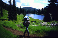
On the Trail

On the Trail
Sid Tate hikes in the Selway-Bitterroot Wilderness

Blog Archive

  • ▼  2018 (2)
    • ▼  May (2)
      • Trail Report - NV to Hammett I biked from the NV b...
      • Memorial Day Ride
  • ►  2016 (6)
    • ►  June (1)
    • ►  May (1)
    • ►  March (3)
    • ►  February (1)
  • ►  2015 (10)
    • ►  December (1)
    • ►  November (1)
    • ►  October (1)
    • ►  August (1)
    • ►  May (1)
    • ►  February (1)
    • ►  January (4)
  • ►  2014 (5)
    • ►  December (1)
    • ►  September (2)
    • ►  January (2)
  • ►  2013 (6)
    • ►  September (2)
    • ►  July (1)
    • ►  January (3)
  • ►  2012 (15)
    • ►  December (1)
    • ►  October (1)
    • ►  August (5)
    • ►  July (3)
    • ►  June (5)
  • ►  2011 (11)
    • ►  December (1)
    • ►  October (1)
    • ►  September (2)
    • ►  August (2)
    • ►  July (1)
    • ►  June (3)
    • ►  March (1)
  • ►  2010 (9)
    • ►  September (2)
    • ►  July (4)
    • ►  June (1)
    • ►  March (1)
    • ►  February (1)
  • ►  2009 (8)
    • ►  September (3)
    • ►  August (2)
    • ►  July (2)
    • ►  June (1)
  • ►  2008 (5)
    • ►  October (1)
    • ►  August (1)
    • ►  July (3)

Contributors

  • 1morestep
  • 43rd Parallel - John and some VIPs
  • BDV
  • Claine
  • Clay
  • Dan Styer
  • Dennis Ahern
  • Frog Finnegan
  • GottaWalk
  • Leo Hennessy
  • Mike O'Brien
  • Paige
  • Ron
  • Russmiller
  • Steve Stuebner
  • Steve
  • Tom
  • Unknown
  • Unknown
  • Unknown
  • Unknown
  • Unknown
  • Unknown
  • Unknown
  • Unknown
  • Unknown
  • Unknown
  • dnakker
  • dougmetzgar
  • gerardocallaghan
  • the spatial juan