Sunday, October 2, 2011

ICT - A Piece at a time - Leg 7

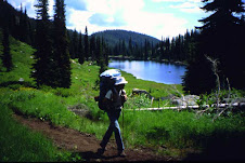
On October 1 we hiked from Grandjean to Stanley Lake on the ICT. The total distance was 11.4 miles. It took us a little over 6 hours. My yellow lab was our partner on this trip. We had an elevation rise from 5,200 ft. at Grandjean to about 8,100 ft. at the highest saddle during the first 5 miles. The signage for the ICT along the trail is not good, but it is a well worn trail and fairly easy to navigate. Even this late in the year there was water all along the route. The weather was great and the fall colors were glorious. The route we took follows along with a few photos. John and Hank.


Wednesday, September 14, 2011

ICT - A Piece at a Time - Leg 6

On September 10th, 2011, Hank and I biked from Burgdorf Hot Springs to the Wind River Pack Bridge on the Salmon River. This is on the Western Alternate section of the ICT. We went up the Jeanette Creek trail from an elevation of about 6,200 ft. to 8150 ft (more pushing than riding). Fortunately a trail crew had come through about 2 weeks earlier and cleared the deadfall, otherwise we would have had to lift our bikes over several hundred logs. We did not have to hop a single log on this trip. Something to seriously consider before biking this section. We thought the downhill trip (about 12 miles) would be relatively easy, but not so. The upper portion was not too bad, but was dusty and rocky. The lower portion on the Carey Creek side was very steep, rocky, rutted and dusty from trail bikes. This made biking treacherous and difficult. Brakes all the way and had to walk the bikes quite a bit. We both took a spill and got wounded, but not seriously. My brake cables stretched 1 inch. There was lots of water along the way if you need it, even near the top.

Overall it was a great trip on the ICT, as usual, with lots of great views and wildlife, but next time I would hike it and leave the bikes at home. The total distance was about 22 miles and it took us 9 hours to complete. Following is a photo of our route and a few more photos of the trip.

Burgdorf Hot Springs to the Wind River Pack Bridge on the Salmon River.


Burgdorf Hot Springs cabin the night before our ride.


Hundreds of these sawed away thanks to a trail crew.


The Salmon River is down in the far valley.


John White and Hank Boomer taking a break at 8100 ft. elevation.


Going to cool off at the end of our ride at the Wind River Pack Bridge.


Thursday, September 8, 2011

Paige and Nick,
700 miles is quite an accomplishment! I'd love to read more details about your hike: where you had trouble finding the way, what the ridge north of Magruder road was like, what springs were dry, etc.
Mike O'Brien

Wednesday, August 10, 2011

ICT ?

I am planning a trip for next summer so I am looking for some trail information. I am considering a solo thru-hike. I would like to hike the entire trail system including the alternate routes. I would like to speak with anyone that has hiked the trail especially anyone who has done something similar. I anticipate many questions and I would appreciate any input. Is 1,200 miles accurate for the trail including the alternate routes? I look forward to hearing from you. Thank You,BZ

Wednesday, August 3, 2011

class of 2011

I did it!

it was actually 76 miles left to go, not 65. and I finished on Thursday evening, July 28th, at about 9:10 pm Pacific time, at Lionhead campground. I wanted the big dramatic finish at Upper Priest Falls, but the way it worked out, it was better to go to the falls then work our way south back to Lionhead campground on the northern tip of Priest Lake.

thanks to Stephen Stuebner for his book on the ICT.

thanks to Leo Hennessey for my first taste of the ICT 7 years ago on a work hike on North Fork Lime Creek.

thanks to my chief partner in crime on the ICT, Jerry "Frog" Finnegan. together we are "Doofus and Lark" exploring across Idaho!

thanks go also to the many friends who have joined me for segments of the ICT and for the many family members who have helped me with shuttle rides.

Ron Whittaker
"Llamamoto"

http://llamasyndrome.blogspot.com

Wednesday, July 27, 2011

He's headin' for home!

As of July 26th Ron Whittaker has completed all but the upper 23 miles or so of the ICT. He's planning to complete his seven year adventure on Thursday July 28th!
Watch out for those snow fields Ron, and congratulations!

Tuesday, June 28, 2011

Our First ICT Segment--June 23-25, 2011

Hammett to Highway 20/Camas Reservoir
Day 1: 13 miles. Bryan and I set off from the 84 at N. Hammett Hill Road exit at 1:30 p.m. Despite 90-degree temps and relentlessly hot pavement, we got lucky with cool winds, lots of clouds and desert rain showers that made their way around us instead of giving us a good soaking. The trail here is mostly paved and gravel roads, and the trail markers are clearly visible. We saw plenty of wildlife despite the heat, including rabbits, badgers, deer, hawks, pheasant and quail.

Day 2: 16 miles. Set off at 8 a.m. for an all-day, uphill hike into Little Canyon. Great valley views from the surrounding buttes. Climbing out of the valley was finally on-trail, a refreshing break from the noisy, crunchy gravel roads, but it wasn't long before we were back on the road when the trail joined Bennett Mountain Road heading up to Mount Bennett. Lots of cattle out grazing. Sometimes an entire herd was our audience as we passed by. This portion of trail is spectacular this time of year--the flowers are in bloom, the hills are green and the snakes and lizards are sunning themselves. We stopped just short of the summit to make camp and rest.

Day 3: Six miles. Headed out early to take advantage of the cool morning air and meet our noon ride at Cat Creek Rd. and Highway 20. We enjoyed great mountain views once we reached the summit. Near the end of the trail, we surprised a few Harley riders who thought they were alone, enjoying a beer. They asked us a lot about the ICT and wished us luck.

You can view all of our photos here. BTW -- Bryan and I are avid backpackers who are taking on the ICT in segments. We're based in Boise and can help anyone seeking assistance/support as they make their way through the southern portion of the ICT. We'll post our own progress as we complete each segment (give us a few years).

Friday, June 3, 2011

One Month to Departure !

It seems we may be the only ones committed to an unassisted thru-hike on the ICT this summer, but we are excited and finishing up our planning, cooking, and packaging in the coming weeks. We plan to hit the trail on July 4th and thought other ICT enthusiasts might be interested to follow our adventure this summer. I am planning on updating my personal blog with details. I haven't figured out how I will manage this while on the trail, but optimistically, here's the link: http://www.guernsi.blogspot.com

One detail which we are working on currently are resupply locations. If anyone has a list with phone numbers and addresses, we would greatly appreciate it. Thanks !

Cheers,
Paige and Nick

Wednesday, June 1, 2011

Hi,

We are planning to at least attempt part of the ICT when we visit next year. We will be flying into Bozeman Montanna from UK.
Can anyone advice what section we should do that offers medium to hard challenge, good views etc and where we can pick it up (the trail) that's convenient to where we land.

Thanks
Gerard

Monday, March 28, 2011

65 miles left

Hello all:
I am anticipating the completion of my ICT quest this summer. This year will make 7 years that I have been working on it. I have 65 miles left to make the chain complete. The first section is 30 miles on the Stateline Trail, from Missoula Lake north to near Dominion Peak. The last and grand finale' section will be from Priest Lake, near Indian Creek, north to the falls just south of the Canadian border. Targeting last week of July for completion. What plans does everyone have for the ICT this summer? Ron http://llamasyndrome.blogspot.com

Saturday, September 18, 2010

ICT - A Piece at a Time - Leg 5

Over the period from July 15th to the 17th we biked a section from the Hunter Creek Transer Station above Anderson Ranch Reservoir to Castle Rocks and then hiked from the Willow Creek trailhead back to our starting point at Hunter Creek Transfer Station. The biking portion was relatively easy and downhill most of the way. The Castle Rock area was the high-light of that section. We started the hiking portion about noon on a hot dry day. We climbed about 2,500 that afternoon and it tested us a little. We found water fairly high, but ran out before we reached the highest saddle. Extra water is needed on this section when it is a hot summer day. As we headed down the Lime Creek draw, that little trickle of water was a very pleasant sound. A sheep band had been in there just before us, but we still managed to get some good water. We forded Lime Creek multiple times. Plan to get wet if you travel at this time of the year. We camped along Lime Creek and then enjoyed a liesurely hike back to the Hunter Creek Station where we had a vehicle waiting. We covered a total of about 38 miles on this section.
John White and Hank Boomer.
Photos of this section of our trek can be seen at the following web site:

ICT - A Piece at a Time - Leg 4

On May 16, 2010 Hank and I tackled our 4th leg of the Idaho Centennial Trail. We biked from the Cat Creek Summit area to the Snake River bridge near Hammett. Great weather and a great trip. We had some fast biking down the grade toward Hammett and some slow hiking through the Hoodoo rock formations above Hammett. We covered about 4o miles on this section. We did this the day after we finished our 3rd leg. You can see photos our trip at the following web site:

http://picasaweb.google.com/jetjwhite/Leg4ICTCatCreekSummitToHammettBridge05162010##

Thursday, July 29, 2010

ICT - A Piece at a Time - Leg 3


On May 15th we tackled our third leg of the Idaho centennial trail. We biked from the Nevada border to the rafting put-in road for the upper Bruneau River. For this portion we camped the night before near Murphy Hot Springs and did most of our ride starting in the morning. There is no water on this approximate 40 mile section so we carried plenty. The trail was much rougher than Leg 2. We did not have recent grading and the cattle had made plenty of tracks in the mud which had dried into very regular bumps. The rocks added their portion so riding was not as pleasant. The day was gorgeous which made up for the rough ride. The auto shuttles on this section were very long across some very straight desert roads. We saw many antelope and sage hens with lots of blue sky. You can see our photos at the following web site:

Monday, July 26, 2010

ICT - A Piece at a Time - Leg 2


On April 11th we (Hank Boomer and John White) tackled our second leg of the trail with a biking section in the southern desert. We travelled north from the road that leads to the Bruneau River for rafting put-ins to the Bruneau Canyon overlook where we had started Leg 1 of our journey. We were fortunate that a good portion of the trail had been graded in the spring after some heavy rains. It made the trail much smoother than it normally would have been. It was quite a warm day so we were glad that we packed 3 liters of water each. All in all, it was a beautiful day to be in the desert. The photo trip report can be seen at the following web site:


Thursday, July 22, 2010

ICT - A Piece at a Time - Leg 1

Bruneau Canyon Overlook to the Snake River Bridge near Hammet

On March 20, 2010 Hank Boomer and I (John White) began our quest to travel the Idaho Centennial Trail, either by hiking or biking. This first section was a challenge for us because we tackled 20 miles, but we were able to complete it in one day and thoroughly enjoyed early spring in the desert. The signage in this section was quite good and we had no trouble finding our way. More to come. You can see our photos at the following web site:

http://picasaweb.google.com/jetjwhite/Leg1ICTBruneauOverlookToSnakeRiverBridgeAtHammet03202010#

Tuesday, July 20, 2010

ICT - A Piece at a Time - Introduction


A friend of mine, Hank Boomer, and I decided that we would begin to travel the Idaho Centennial Trail in 2010. Our goal is to complete it sometime, just not sure when. We plan to travel the full length either by hiking or biking. Our trips are not in order from beginning to end, but are a piece at a time when and where we can make it. We have been Idahoans all of our lives and value this wonderful state in which we live. We are not purists when it comes to back country travel, but we take out what we bring in and we protect the land we pass through. We are both still employed and can only take on small sections at a time. I will be posting some photo trip reports shortly which will give you an idea of what we have experienced. It is a pleasure and a treasure to experience the ICT at this time in our lives. We hope the information we share has value.
John White.

Thursday, June 10, 2010

2010 ICT Hikers

Who has ICT plans for 2010? Starting where and when, which direction and how far? I'm wishing all hikers a great adventure!

Be sure to sign Trail Registers at the Hammett, Mullan, Clark Fork and Naples Post Offices.

Thursday, March 25, 2010

Dogs

Little Earth,

Dogs are welcome on all of the trails but you might have to leash them in the Sawtooth Wilderness depending on the time of year you are traveling through the wilderness. I think July 1st to Sept 1st you need to have them on leash.

Friday, February 19, 2010

ICT talk at Boise REI 3/17/2010

Ken and I have an hour long presentation on our ICT hike. REI in Boise will host the presentation as one of their regular events on Wednesday evening, March 17th at 7pm.

Wednesday, September 16, 2009

Bart Robinson

Bart finished his ICT hike on Tuesday 09-15-09. I have been following his Facebook/Twitter posts and tracking his position on Google maps. Congratulations on completing the ICT Bart!